
We are leaving Las Vegas for
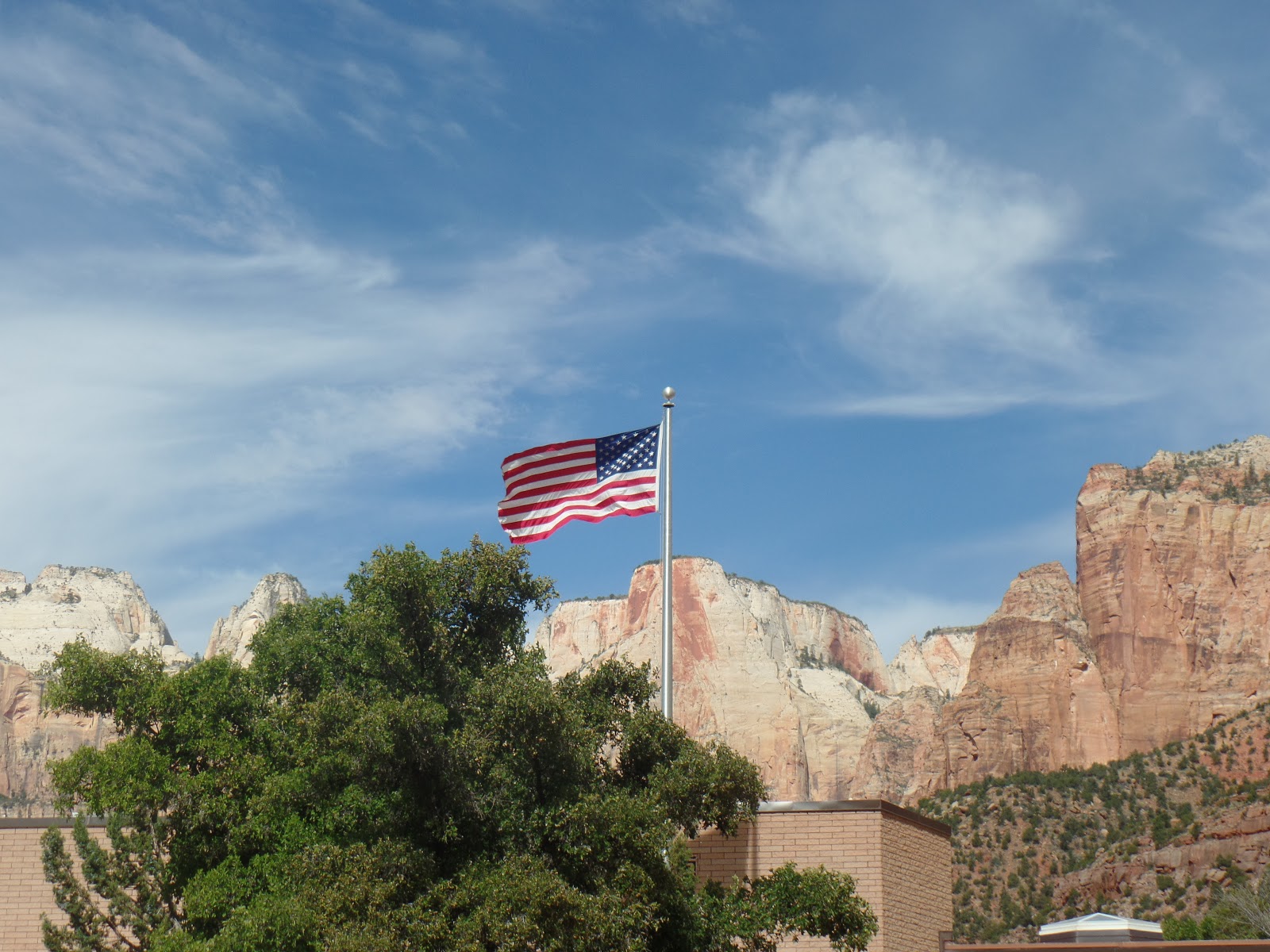
Zion National Park
and
Bryce Canyon
with

We enjoyed our day trip with
Adventure Photo Tour.
We departed Las Vegas at 6:00 AM.


Complimentary hotel pickup , a boxed lunch,
and a wonderful day away from the casinos.


masterpieces of the beautiful landscape.


Navajo Sandstone is the rock dominating Zion National Park. This massive formation is 1500 to 2000 feet thick and is characterized by its cross-bedding, because it developed from ancient sand dunes. Some lower parts of the formation were deposited in shallow water with the cross-bedding caused by currents. The Aeolian (windblown) cross-bedding formed as shore dunes were affected by prevailing winds. Any
shift in wind direction intensifies the cross-bedding effect. The most striking cross-bed sets are displayed in the upper parts of the Navajo Formation, like those found in Checkerboard Mesa and other cliffs along the Zion-Mt. Carmel highway.
Read more: https://www.desertusa.com/zion/du_znpdesc.html#ixzz54BRsscsK

attracted by the warm climate and agricultural potential of southwestern
Utah, scouted for permanent settlements in the region.
Historical records attribute the naming of
"Zion" to Isaac Behunin,
who built a cabin near what is not the site of Zion Lodge.
(taken for brochure from Adventure Photos)

In the mid 1800’s a few Mormon explorers and settlers became aware of the remarkable canyons but it wasn’t until 1908 that the federal government completed a survey of Zion National Park. The findings were brought to the attention of President William Howard Taft and he was so impressed that in July 1909, he declared 15,000+ acres of the main canyon a National Monument. The monument was called Mukuntuweap which is a Native American word that is said to mean “Straight Canyon”.
https://www.zionponderosa.com/zion-national-park-history/


Patterns in Stone
The Navajo sandstone of Checkerboard Mesa also forms the spectacular cliffs within Zion. This geographically widespread formation reaches a thickness of 2,200 feet in the park and consists almost entirely of desert sand dunes. The Checkerboard Mesa, made of Navajo sandstone, has two sets of lines forming the checkerboard pattern.
The horizontal lines, commonly called cross bedding, represent layers of wind-blown sand that built up into sand dunes. These dunes were then buried, and the sand grains glued together by calcite and iron oxide to form sandstone. Crossbedding can be seen in many place along the Zion Mt. Carmel Highway.
The vertical lines are less common. They are actually shallow cracks that result from stress and erosion on the rock surface. These cracks are probably caused by expansion and contration, temperature changes, wetting/drying, or a combination of these processes.
http://scienceviews.com/photo/library/SIA2477.html


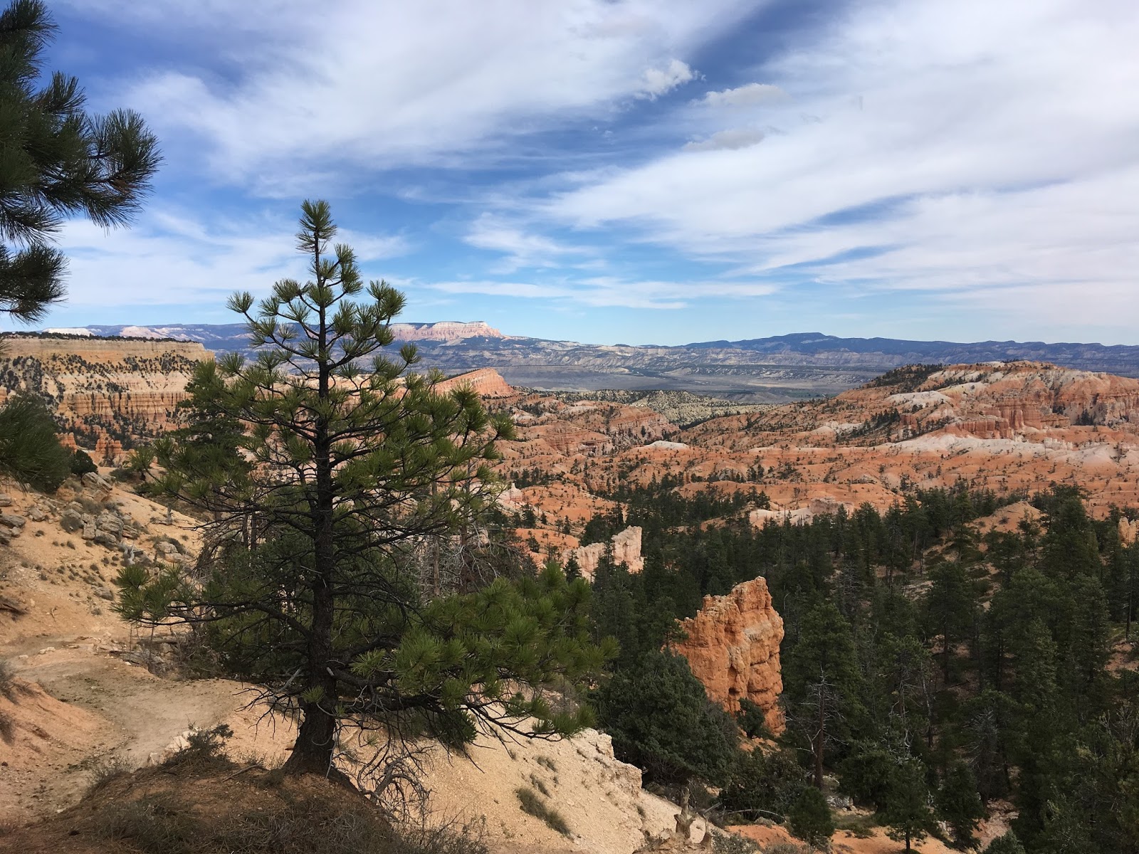
Bryce Canyon is our next stop.


Bryce Canyon became a National Park in 1924. Bryce is famous for its unique geology,
which consists of a series of horseshoe-shaped amphitheaters carved from the eastern edge of the Paunsaugunt Plateau in southern Utah.
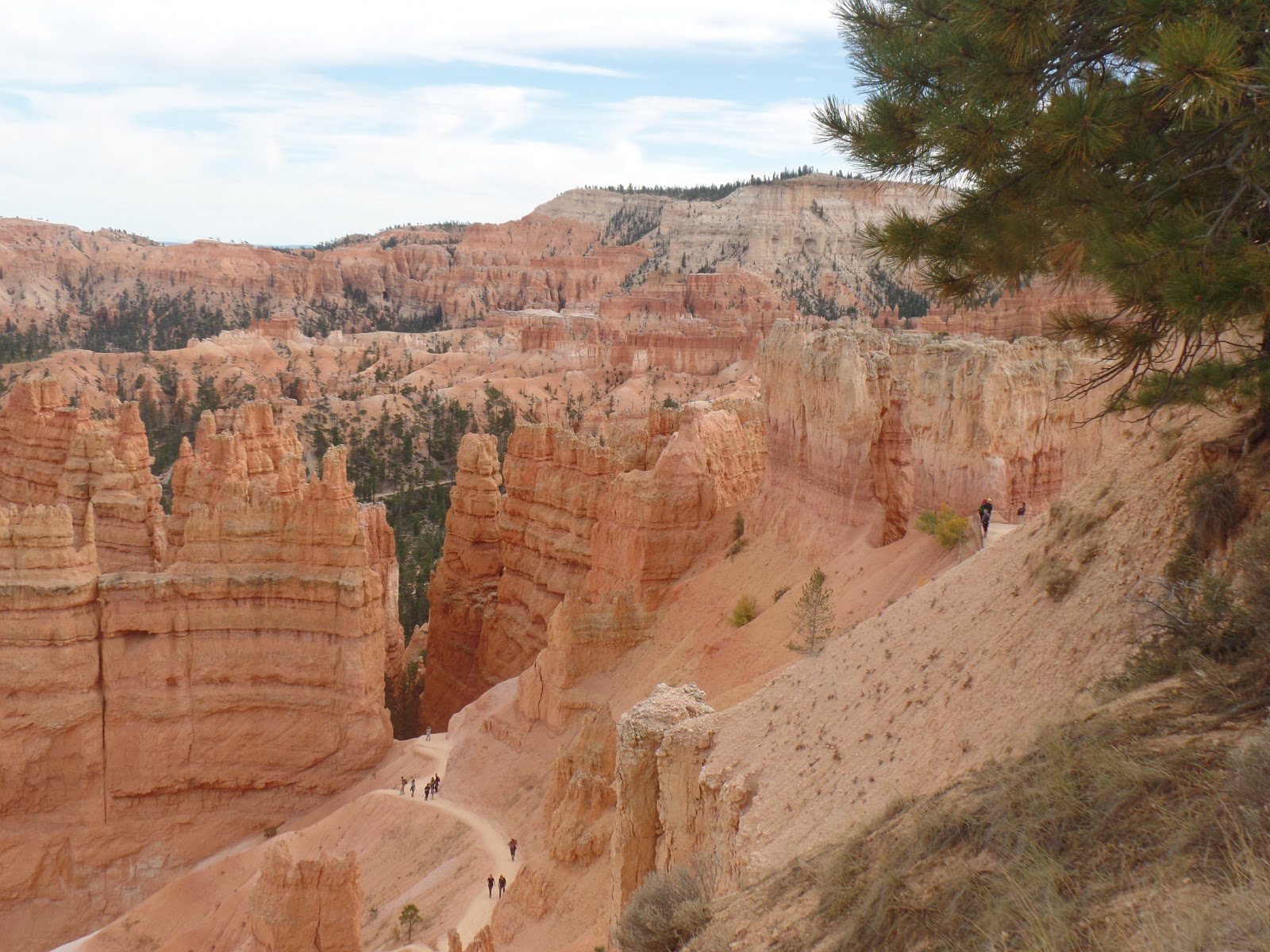
Erosional force has shaped the colorful limestone rock of the Claron Formation into bizarre shapes,
including slot canyons, windows,
fins and spires called hoodoos.
Tinted with colors too numerous and subtle to name,
these whimsically arranged rocks create a wondrous landscape of mazes,
offering some of the most exciting and memorable walks and hikes imaginable.
(https://www.superpages.com/bp/bryce-ut/bryce-canyon-national-park-L2044750830.htm)


Grand Staircase.
The Grand Staircase refers to an immense sequence of sedimentary rock layers
that stretch south from Bryce Canyon National Park and Grand Staircase-
Escalante National Monument,
through Zion National Park, and into the Grand Canyon National Park.
en.wikipedia.org/wiki/Grand_Staircase


who started ranching the area in 1875. Upon showing the canyons to visitors, he is said to have remarked,
“It’s a hell of a place to lose a cow.”
From 12 Fun Facts About Bryce Canyon
http://www.nileguide.com/destination/blog/bryce-canyon-national-park/2010/12/23/12-fun-facts-about-bryce-canyon-national-park/


Rim Trail


it exists in three distinct climatic zones:
spruce or fir forest, Ponderosa Pine forest, and Pinyon Pine or juniper forest.
Bryce Canyon first became a tourist destination in 1916 with Union Pacific.
It was then declared a National Moument in 1923,
and officially established as a National Park in 1928.
(https://www.nationalparks.org/explore-parks/bryce-canyon-national-park)

hoo·doo
[ˈho͞oˌdo͞o]
NOUN
voodoo; witchcraft.
NORTH AMERICAN
a column or pinnacle of weathered rock:
"a towering sandstone hoodoo"
VERB
bewitch:
"she's hoodooed you"

It appears impossible that the destructive forces of water carved these fragile landforms.
Instead many believe the hoodoos of Bryce Canyon were formed by wind.
This is a mistaken idea. Wind is an effective form of erosion for many locations.
However, for Bryce Canyon wind has little effect on the creation
and destruction of the various shapes.
(https://www.desertusa.com/utah-desert/hoodoos.html)

that form the features of surrounding parks.
Water, ice (at varying intervals) and gravity are the forces that form Bryce Canyon.
These three erosive forces coupled with the differential erosion of the four rock types of the Claron Formation produced a different morphology than that of other parks.
10-15 million years ago the Paunsaugunt Plateau was caught and uplifted by the Colorado Plateau. Breaks called joints formed in the plateau during the uplift.
Joints allowed water to flow into the rock.
As water flowed through joints erosion widened them into rivulets and gullies.
Over time, deep slot canyons formed in the sides of the plateau.
(https://www.desertusa.com/utah-desert/hoodoos.html)
is the most efficient form of erosion for breaking rock into smaller pieces.
The Paunsaugunt Plateau receives approximately 100 inches of snowfall a year.
It also experiences about 200 days of freeze/ thaw.
Which means that everyday a small amount of snow melts
and runs into the joints and freezes at night.
When water freezes it expands to form an ice wedge in the joint widening the space.
As the ice wedge grows by more water leaking into the joint and freezing
it will finally break the rock.
(https://www.desertusa.com/utah-desert/hoodoos.html)

Small pebbles and large Volkswagen bus sized boulders
commonly fall from the sides of existing hoodoos
and the sides of the Paunsaugunt Plateau by frost wedging and gravity.
The smaller pieces are washed away by the monsoons and snow melt.
Boulders explode into cobble sized pieces when they impact the ground.
The resulting debris is washed down slope by snowmelt, flashfloods and gravity.
(https://www.desertusa.com/utah-desert/hoodoos.html)


(From 12 Fun Facts of Bryce Canyon)


“The beauty and charm of the wilderness are his for the asking,
for the edges of the wilderness lie close beside the beaten roads of the present travel.”
— President Theodore Roosevelt


No comments:
Post a Comment